WHAT: A strong, possibly severe, thunderstorm
WHEN: Noon to 3:00 pm
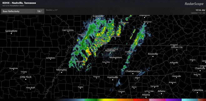
Current radar shows two areas of showers and storms making their way across Middle TN. One batch is developing right on top of us now and another is developing just west of Nashville. There are no watches or warnings active for TN at this hour. At this point, there’s no intention by the Storm Prediction Center to issue a watch. A few storms are strong and may even become briefly severe this afternoon.
The Storm Prediction Center, at the 11:30 update, continues to highlight our area in the MARGINAL RISK for severe storms. This is the lowest of the five severe weather categories. The risk for a damaging wind gusts and/or hail up to one inch in diameter is low, but not zero.

My level of concern is unchanged from this morning and is right in the middle of the low zone. My main concern is for a damaging wind gusts. Winds are already quite gusty, so it won’t take much to produce a damaging wind gust. There are sporadic power outages across the plateau from these gusty winds that we already have.

That squall line of rough storms that I showed you all last night has really helped lower today’s severe weather risk across the entire Southeast. The latest update from the SPC has now lowered the threat for everyone, even taking down the slight risk area that was outlined for much of Alabama and Georgia. That squall line pushed south last night and cut off the rich, moist flow of Gulf air coming northward. With that fuel source cut off, storms will struggle today.
I’ll keep an eye on things and update, as needed! You all take care.
