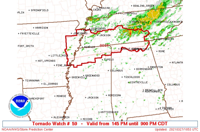
The Storm Prediction Center just issued a tornado watch for southern portions of West and Middle Tennessee. This is the watch that I’ve been waiting for since the last post. The watch does not include any of the counties of the plateau or any of the counties around us. That watch is outlined below. Thankfully, the plateau is still getting rain.
Temps are continuing to hold in the 50s for much of the plateau and that is very good news! As long as we stay cloudy and rain-cooled, we’ll have a good chance of being alright this afternoon.
Please keep in mind that we still have the storm threat coming after midnight. I’m continuing to monitor that very closely and that still has the potential to be a serious line of storms when it comes through. I’ll keep you posted.
The situations I spoke of in the noon post continue to hold true. Please refer to that blog post if you haven’t already read it.
Storms this afternoon will continue to pose a risk for lightning and heavy rainfall. Some stronger storms could even contain some small hail.
I’m here monitoring it all. There’s a lot of data coming in right now and that should show a clearer picture for how our overnight storms will unfold. Stay tuned and stay weather aware.
Remember, follow the blog to get updates sent to your email. Just find that “Follow” button in the lower right corner of your screen. Thank you!

thank you mark