Posted on Leave a comment

MM’s Sun Wx Forecast for June 26

Wx Summary

A slow-moving cold front will bring the risk for scattered showers and thunderstorms today, especially in the afternoon and evening. That rain chance increases further overnight, with most (if not all) of us getting some rain. The front pushes through by Monday morning, leaving us with just a few showers to start our new workday of the new workweek. Behind the front, we’ll see pleasant weather through Thursday.
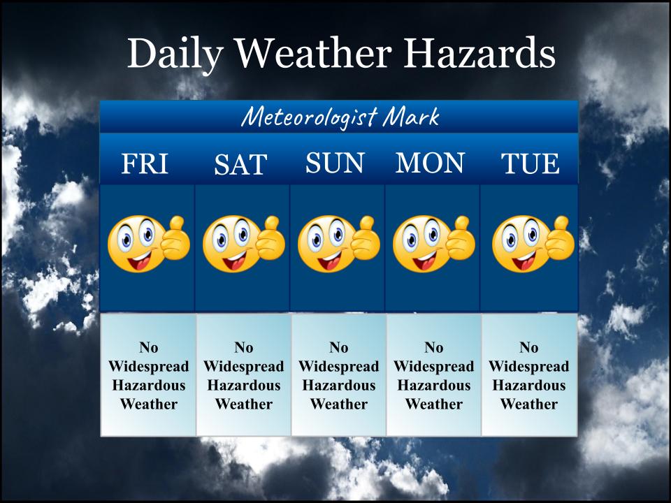
This Week’s Hazards

MM’s Wx Vlog

Weather Forecast

Sunday: Partly to mostly cloudy, with scattered mainly afternoon/evening showers and storms. Showers and storms are expected to increase in coverage into the overnight hours.

Monday: Chance morning showers. Cooler.

Tuesday – Wednesday: Mostly sunny and cooler and less humid.

Thursday: Partly cloudy and warmer.

MM’s Severe Wx Concerns 

The Storm Prediction Center has placed our region in the MARGINAL RISK for severe storms for this afternoon and tonight. Just be aware that any storm that develops could be locally strong to briefly severe.

 SPC T-storm Outlook for Today

HRRR Radar Model

This simulation is from 9:00 a.m. this morning to 9:00 p.m. this evening. Most of our scattered t-storm activity will come later today.

Wind Forecast

Time is in 24 hour units, beginning at 7:00 a.m. today. Simply scroll to the right to see future hours.

Date06/2606/27
Hour (CDT)070809101112131415161718192021222300010203040506
Surface Wind (mph)667777767666332233223556
Wind DirSSWSSWSSWSWWSWWSWWSWWSWWSWWSWWSWSSWWSWSSSWSWSWWSWWWNWNWNNWN
Gust

Drought Outlook

Drought info can be found at my link at https://meteorologistmark.com/drought-info/. That link also allows you to compare this week’s map with last week’s. The maps update each Thursday.

On This Day

1994- Middle Tennessee is struck by four tornadoes during the evening. The worst is an F-3, which travels a remarkable 38 miles, touching down at Lutts (Wayne County), and traveling southeastward, passing through Iron City and St. Joseph before crossing the Alabama state line. There are 22 injuries, but no fatalities. Six more persons are injured along a four-mile F-2 path near Altamont (Grundy County). And an F-1 touches down near Topsy (Wayne County), cutting a five-mile path, but with no reported injuries.

1917 – 1st US troops arrive in France during World War I.

Almanac

Hurricane Forecast

The yellow-shaded region is drifting westward from the Lousiana coast, so you folks with beach plans to Florida or the Alabama coast will not be affected by this particular system. The system will impact Texas by the start of this workweek.

Another area of low pressure now has a 70% chance for development (red-shaded region). That system may stay too far south to impact the U.S., though it still bears watching in the coming week.

MM Classes for Kids

Registration for the MM kids classes in July is now open! Classes cap at 15 students. The topic for July’s classes is rockets!

For the Crossville class, register at https://docs.google.com/forms/d/e/1FAIpQLSfvhcw3cXep6sfQaIFlV7W02HDLBJ5pBoISxNYEjLufIl5ctw/viewform

For the Clarkrange class, register at https://docs.google.com/forms/d/e/1FAIpQLSdN9gy7OO1wv7TOzCDT2LDuq6_wkUovW_cpaRCzvy1QNsGgDg/viewform

MeteorologistMarkPro 

This week’s MM newsletter is about past record warmth that we’ve experienced here on the plateau. If you find this kind of info interesting, you might consider subscribing to the newsletter at https://meteorologistmarkpro.com/! It’s only $5 a month or $50 a year, with proceeds supporting my education outreach programs with the kids.

You all have a great day and keep lookin’ up!

Make sure you “Follow” this blog to get updates in your email inbox

Posted on Leave a comment

MM’s Sat Wx Forecast for June 25

Wx Summary

An unsettled weather pattern has developed across the region and that will lead to rain for most, if not all, of us by Monday. For our Saturday, just look for a chance for afternoon and evening showers and storms. Not everyone will see them, but there will likely be some storms around the area. By Sunday, that rain chance increases to 50% coverage. By Sunday evening and night, that chance increases to at least 80%! The front pushes through on Monday, kicking up a few more storms, before leaving us with cooler and less humid conditions for Tuesday and Wednesday.

MM’s Wx Vlog

This Week’s Hazards

Just keep in mind that any storm that develops can be locally strong.

Weather Forecast

Saturday: Partly cloudy, with a chance for an afternoon or evening shower or storm.

Sunday: Partly to mostly cloudy, with scattered showers and storms. Showers and storms are expected to increase in coverage into the evening and overnight.

Monday: Scattered showers and thunderstorms. Cooler.

Tuesday – Wednesday: Partly cloudy and cooler and less humid.

MM’s Severe Wx Concerns 

Just keep in mind that storms this time of year can be locally strong to even breifly severe. These storms can also produce torrential rainfall that can lead to flash flooding. Widespread severe weather is not expected.

 SPC T-storm Outlook for Today

HRRR Radar Model

This simulation is from 11:00 a.m. this morning to 11:00 p.m. this evening.

Wind Forecast 

Time is in 24 hour units, beginning at 7:00 a.m. today. Simply scroll to the right to see future hours. 

Date06/2506/26
Hour (CDT)070809101112131415161718192021222300010203040506
Surface Wind (mph)667889877766555333323333
Wind DirSSSSSSSSSSSSSSSESSESSESSESSSSSSS
Gust

Drought Outlook

Drought info can be found at my link at https://meteorologistmark.com/drought-info/. That link also allows you to compare this week’s map with last week’s. The maps update each Thursday.

On This Day

1749 – A general fast was called on account of drought in Massachusetts. It was the year of the famous dry spring in which fields and villages burned.

1929 – US President Herbert Hoover authorizes building of Boulder Dam (Hoover Dam).

Almanac

Hurricane Forecast

There are now two areas to monitor for possible tropical development. Both are not expected to be problematic until early next week. The yellow-shaded area should be of interest to anyone with beach plans next week. The orange-shaded region may stay too far south to impact the U.S.

MM Classes for Kids

Registration for the MM kids classes in July is now open! Classes cap at 15 students. The topic for July’s classes is rockets!

For the Crossville class, register at https://docs.google.com/forms/d/e/1FAIpQLSfvhcw3cXep6sfQaIFlV7W02HDLBJ5pBoISxNYEjLufIl5ctw/viewform

For the Clarkrange class, register at https://docs.google.com/forms/d/e/1FAIpQLSdN9gy7OO1wv7TOzCDT2LDuq6_wkUovW_cpaRCzvy1QNsGgDg/viewform

MeteorologistMarkPro 

This week’s MM newsletter is about past record warmth that we’ve experienced here on the plateau. If you find this kind of info interesting, you might consider subscribing to the newsletter at https://meteorologistmarkpro.com/! It’s only $5 a month or $50 a year, with proceeds supporting my education outreach programs with the kids.

You all have a great day and keep lookin’ up!

Make sure you “Follow” this blog to get updates in your email inbox

Posted on Leave a comment

MM’s Fri Wx Forecast for June 24

Wx Summary

A very warm Friday is in store for the plateau, with only the slightest risk for an evening shower or storm. Those rain chances increase a bit for the weekend. In fact, by Sunday night the rain chance is set at 50%. That activity lingers into Monday before the front pushes it out of here.

Friday Funny

This Week’s Hazards

MM’s Wx Vlog

Weather Forecast

Friday: Partly to mostly sunny and hot.

Saturday: Partly cloudy, with a slight chance for a shower or storm.

Sunday: Partly sunny, with a chance for showers and storms. Showers and storms are expected to increase in coverage overnight.

Monday: Scattered showers and thunderstorms. Cooler.

Tuesday: Partly cloudy.

 SPC T-storm Outlook for Today

HRRR Radar Model

This simulation runs from 11:00 am to 11:00 pm. Notice that there could be some isolated activity late into the evening.

Wind Forecast

Time is in 24 hour units, beginning at 7:00 a.m. today. Simply scroll to the right to see future hours. 

Date06/2406/25
Hour (CDT)070809101112131415161718192021222300010203040506
Surface Wind (mph)222222222222222122222222
Wind DirENEEEESESESSSSESEENENNEENEEEESEESESESSSSSS
Gust


Drought Outlook

Drought info can be found at my link at https://meteorologistmark.com/drought-info/. That link also allows you to compare this week’s map with last week’s. The maps update each Thursday.

On This Day

1924 – Six men at a rock quarry south of Winston-Salem, NC, sought shelter from a thunderstorm. The structure chosen contained a quantity of dynamite. Lightning struck a near-by tree causing the dynamite to explode. The men were killed instantly.

1930 – 1st detection of airplane using reflected radio waves, a precursor to radar, by US Naval Research Laboratory engineers, Anacostia, Washington, D.C.

Almanac

Hurricane Forecast

An area of disturbed weather is being watched closely in the Atlantic. This is about a week away from getting into the Caribbean (that farthest west point on the shaded path below). This will likely become our next named storm.

MM Classes for Kids

Registration for the MM kids classes in July is now open! Classes cap at 15 students. The topic for July’s classes is rockets!

For the Crossville class, register at https://docs.google.com/forms/d/e/1FAIpQLSfvhcw3cXep6sfQaIFlV7W02HDLBJ5pBoISxNYEjLufIl5ctw/viewform

For the Clarkrange class, register at https://docs.google.com/forms/d/e/1FAIpQLSdN9gy7OO1wv7TOzCDT2LDuq6_wkUovW_cpaRCzvy1QNsGgDg/viewform

MeteorologistMarkPro 

This week’s MM newsletter is about a story I found about a little town in West Virginia and how they deal with the heat. It’s interesting enough to share in a newsletter! That letter will publish by this afternoon. If you find this kind of info interesting, you might consider subscribing to the newsletter at https://meteorologistmarkpro.com/! It’s only $5 a month or $50 a year, with proceeds supporting my education outreach programs with the kids.

You all have a great day and keep lookin’ up!

Make sure you “Follow” this blog to get updates in your email inbox

Posted on Leave a comment

MM’s Thur Wx Forecast for June 23

Special Note

According to the NWS Nashville, Nashville hit 101° on Wednesday. This is the first time in 10 years (since July 8 2012) that the temp was 100° or higher, the 3rd longest stretch without 100° on record. The longest stretch was 13 years from Aug 13 1881 to Aug 13 1894.

Wx Summary

A weak cold front has passed through the area, leaving us with a couple of nice and dry days. Temps and humidity will be lower both today and tomorrow. By Saturday, humidity begins to return, which also means a return to a chance (albeit slight) for an afternoon shower or storm. That rain rain chances increases a bit for Sunday and then increases to 50% by Sunday and Monday, as a cold front moves in. Behind that cold front, temps will cool off and humidity will drop back down to comfortable levels.

This Week’s Hazards

MM’s Wx Vlog

Weather Forecast

Thursday: Partly cloudy and slightly cooler.

Friday: Partly to mostly sunny and hot.

Saturday: Partly cloudy, with a slight chance for a shower or storm.

Sunday: Partly sunny, with a chance for showers and storms. Showers and storms are expected to increase in coverage overnight.

Monday: Scattered showers and thunderstorms. Cooler.

 SPC T-storm Outlook for Today

HRRR Radar Model

No precip to show.

Wind Forecast

Time is in 24 hour units, beginning at 6:00 a.m. today. Simply scroll to the right to see future hours. 

Date06/2306/24
Hour (CDT)070809101112131415161718192021222300010203040506
Surface Wind (mph)5566799109988763323333333
Wind DirNNNNNNNNWNNWNNNNNNNNNNNENENENENENEENE
Gust

Three-Day Rainfall Forecast 

Drought Outlook

Drought info can be found at my link at https://meteorologistmark.com/drought-info/. The maps update each Thursday.

On This Day

1944 – Four tornadoes killed 153 persons and caused five million dollars damage in Pennsylvania, West Virginia and Maryland. The tornadoes formed during the evening and moved southeast along parallel paths flattening everything in their way. The town of Shinnston, West Virginia was leveled, and was left with the majority of the casualities. Until that time it was believed that damaging tornadoes did not travel across mountainous terrain.

1974 – 1st extraterrestrial message sent from Earth into space.

Almanac

Hurricane Forecast

The hurricane center is now monitoring a disturbance in the Atlantic. This is more similar to something we would expect in August, rather than June. We’ll see how it develops in the coming days!

MM News

I’ll be at Crab Orchard Elementary this morning to talk to the kiddos about weather and space!

MM Classes for Kids

Registration for the MM kids classes in July is now open! Classes cap at 15 students. The topic for July’s classes is rockets!

For the Crossville class, register at https://docs.google.com/forms/d/e/1FAIpQLSfvhcw3cXep6sfQaIFlV7W02HDLBJ5pBoISxNYEjLufIl5ctw/viewform

For the Clarkrange class, register at https://docs.google.com/forms/d/e/1FAIpQLSdN9gy7OO1wv7TOzCDT2LDuq6_wkUovW_cpaRCzvy1QNsGgDg/viewform

MeteorologistMarkPro 

This week’s MM newsletter is about a story I found about a little town in West Virginia and how they deal with the heat. It’s interesting enough to share in a newsletter! That letter will publish by this afternoon. If you find this kind of info interesting, you might consider subscribing to the newsletter at https://meteorologistmarkpro.com/! It’s only $5 a month or $50 a year, with proceeds supporting my education outreach programs with the kids.

You all have a great day and keep lookin’ up!

Make sure you “Follow” this blog to get updates in your email inbox