Headlines
Warm & dry conditions to continue through mid-week
Rain & storms return end of the week
Not expecting widespread severe storms
Meteorologist Mark’s Wx Vlog
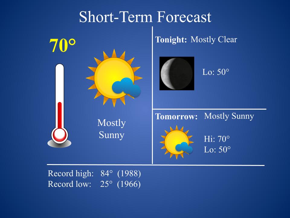
48-Hour WX
48-Hour Precip Forecast

Five-Day Forecast

Daily Forecast Summary
Today & Tomorrow: Mostly sunny and pleasant.
Wednesday: Clouds increase. Breezy. Rain develops overnight.
Thursday: Rain & storms. Breezy.
Friday: Scattered showers.
Meteorologist Mark’s 5-Day Wx Concerns

Meteorologist Mark’s Wx Discussion
The forecast for this week continues to look rather quiet. Storms will be coming in from the west by Wednesday night and Thursday, but they look to be weakening as they approach. That’s always good! When storms are weakening upon approach, they tend to weaken even more rapidly when they hit the plateau. It does look like we could get 1-2 inches of rain, but by then we’ll need the rain.
I should note that you should enjoy these first three days of the week. After Thursday’s rain and thunderstorms, it looks like we’ll be in the path of a series of disturbances that could keep shower chances hanging around through the weekend. Thankfully, warm temps stay around for the next seven days.
Almanac for Yesterday

Solar/Lunar Data

On This Day in Wx History
1987 – A storm produced unprecedented April snows in the central Appalachians. Mount Mitchell in North Carolina received 35 inches of snow, and up to 60 inches (six feet) of snow was reported in the mountains along the border of North Carolina and Tennessee. The total of 25 inches at Charleston, West Virginia, easily surpassed their previous record for the entire month of April of 5.9 inches. The 20.6 inch total at Akron, Ohio, established an all-time record for that location, as well.
A Year Ago Today

76 Days until Summer

Yesterday’s National Temperature Extremes
High: 103° at Ocotillo Wells, California
Low: 5° at Estcourt Station, Maine
Today’s National Wx Hazards
A few severe thunderstorms are possible across southern Minnesota, while a wildfire danger can be found across northeastern Arizona.

Tomorrow’s National Wx Hazards
The severe storm threat shifts southward to Kansas on Tuesday. The wildfire danger also moves east and expands, affecting all of eastern New Mexico and surrounding areas.

Drought Monitor
The drought monitor is updated each Thursday.

NASA Nerdology
New NASA Persevere images in – here’s a wonderful portrait of the first aircraft on another planet. A reprocessed close-up of Ingenuity, patiently waiting to take the first powered flight on another world. How cool is that view?
