Wednesday, December 14, 2022
Next update planned for Thursday at 9:00 am, or as needed
Headline
Windy & Rainy Wednesday
LOCAL WEATHER
MM’s Wx Vlog
Be sure and subscribe to my channel for free at https://www.youtube.com/channel/UCz3zLMT7tqpb6eIaE-8YGog
This Week’s Hazards
Be safe on area roads today, especially where there is standing water.

Five-Day Outlook
Normal High: 48 deg
Normal Low: 31 deg

Five-Day Weather Forecast
Wednesday: Rain likely, some of which could be heavy. Possible thunder. Windy, with gusts to 25 mph.
Thursday: Partly cloudy.
Friday: Partly cloudy. Cold.
The Weekend: Partly cloudy & cold.
Forecast Discussion & Concerns
Our latest storm system has arrived, bringing more rainfall (around 2 inches) to the plateau.
The greatest risk for severe weather with this system will stay well south of the plateau. Our threat will be heavy rainfall that could lead to localized flooding.
This system will bring a pattern change that will lead to an extended period of below normal temps that should be with us through the Christmas holiday.
Forecast 5-Day Rainfall Totals

Weather Stats for Yesterday
Weather statistics extend from midnight to midnight.


Weather statistics are available each day at https://meteorologistmark.com/weather-statistics/
On This Day
1924 – The temperature at Helena, Montana, plunged 79 degrees in 24 hours, and 88 degrees in 34 hours. The mercury plummeted from 63 above to 25 below zero. At Fairfield, Montana the temperature plunged 84 degrees in just 12 hours, from 63 at Noon to 21 below zero at midnight.
2016 – University of Toronto scientists present findings of the world’s oldest water – 2 billion years old from a mine in Canada.
NATIONALLY
National Weather Map for Today
A flash flood risk is highlighted for our area (red-shaded).

Current Snow Depth

Past 24-Hour Temperature Changes
Bluer colors represent colder temps from 24 hours ago this morning, while redder colors indicate warmer temps from 24 hours ago.

Today’s High Temps & Departure from Average
Today’s high temps are shown below. The coloration indicates departure from average, with redder colors indicating above-average high temps and bluer colors indicating below-average high temps. White coloration indicates average temps.
Highest temp expected today: 85 degrees (red star)
Coolest high temp expected today: -2 degrees (blue star)

Tomorrow Morning’s Low Temps & Departure from Average
Tomorrow morning’s low temps are shown below. The coloration indicates departure from average, with redder colors indicating above-average low temps and bluer colors indicating below-average temps. White coloration indicates average temps expected.
Warmest overnight low expected: 76 degrees (red star)
Coolest overnight low expected: -10 degrees (blue star)

MM NEWS
The last class of the year will be offered this evening.

MM Classes for Kids
The next MM kid’s classes will take place in January and February of 2023. The next Crossville class will take place on Wednesday, January 18 at 4:30 pm. The Clarkrange class will take place Thursday, February 2 at 5:00 pm. Registration is required. The class topic will be hail! Registration can be found at https://meteorologistmark.com/mm-kids/

MeteorologistMarkPro
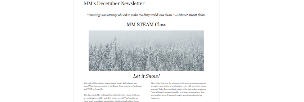
December’s newsletter is out! Learn all about what we discussed in the kids class in November, the weather of Novembers in the past on the plateau, and how lake-effect snow occurs! These topics and more are in this month’s letter! Subscriptions for the newsletter pay for materials used in the MM kids classes each month. To subscribe or try a free sample, go to https://meteorologistmarkpro.com/
Other important weather information will be shared when needed. This includes additional severe weather information, forecast discussion, model data, drought info, hurricane info, and more. Some of these can be found as tabs to this page at any time.
Disclaimer: This website/app should never be considered your primary source of severe weather warnings.

You all have a great day and keep lookin’ up!
